
Indonesian Catastrophe
Muhammad Adimaja/ via REUTERS
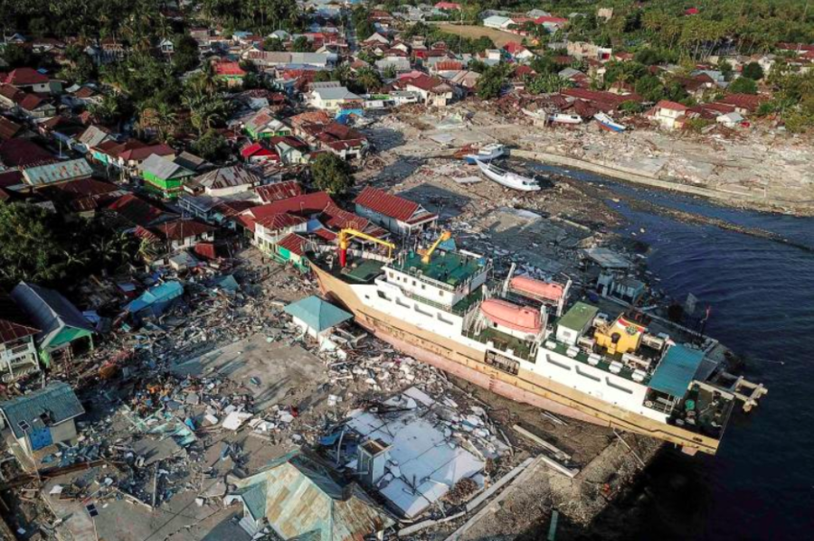
On Friday, September 28, 2018,
a 7.5 magnitude earthquake hit Central Sulawesi, Indonesia. The Sulawesi island is a province located in the Indonesian Islands; this province, in particular, is one of the poorest according to The Economist. The province is less advanced than other parts of Indonesia; the roads are The natural disaster left 2,500 injured or dead and more than 70,000 homeless according to the World Socialists Wet Site from October 6, 2018. In addition to the large destruction of buildings caused by the earthquake: the quake triggered a tsunami that also destroyed roads, bridges, schools, and homes. Furthermore, the three-meter waves that crashed inland created mudslides and blackouts. This incident occurred roughly two months after a series of earthquakes hit Lombok in the West Nusa Tenggara province. The previous tragedy left 500 dead and almost 100,000 people displaced. Indonesia is located on the “Ring of Fire;” therefore, it is prone to experience at least 1,000 to 2,000 earthquakes yearly due to its location on the tectonic plate. According to The Economist, since 2017, 187 earthquakes have occurred that have had a magnitude of 6 or higher; 18 of those have taken place in Indonesia. Volcanic eruptions, as well as tsunamis, are side effects of these larger quakes. Due to Indonesia’s location on the Ring of Fire, the country should invest in the construction of safer housing and infrastructures. Although this may be true, the Indonesian government fails to take precautions during these natural experiences; essentially, the government refuses to further educate the population about the earthquakes. It is said by the World Socialists Web Site that in the first five minutes of the earthquake, most people did not understand what was going on and didn’t know how to react.